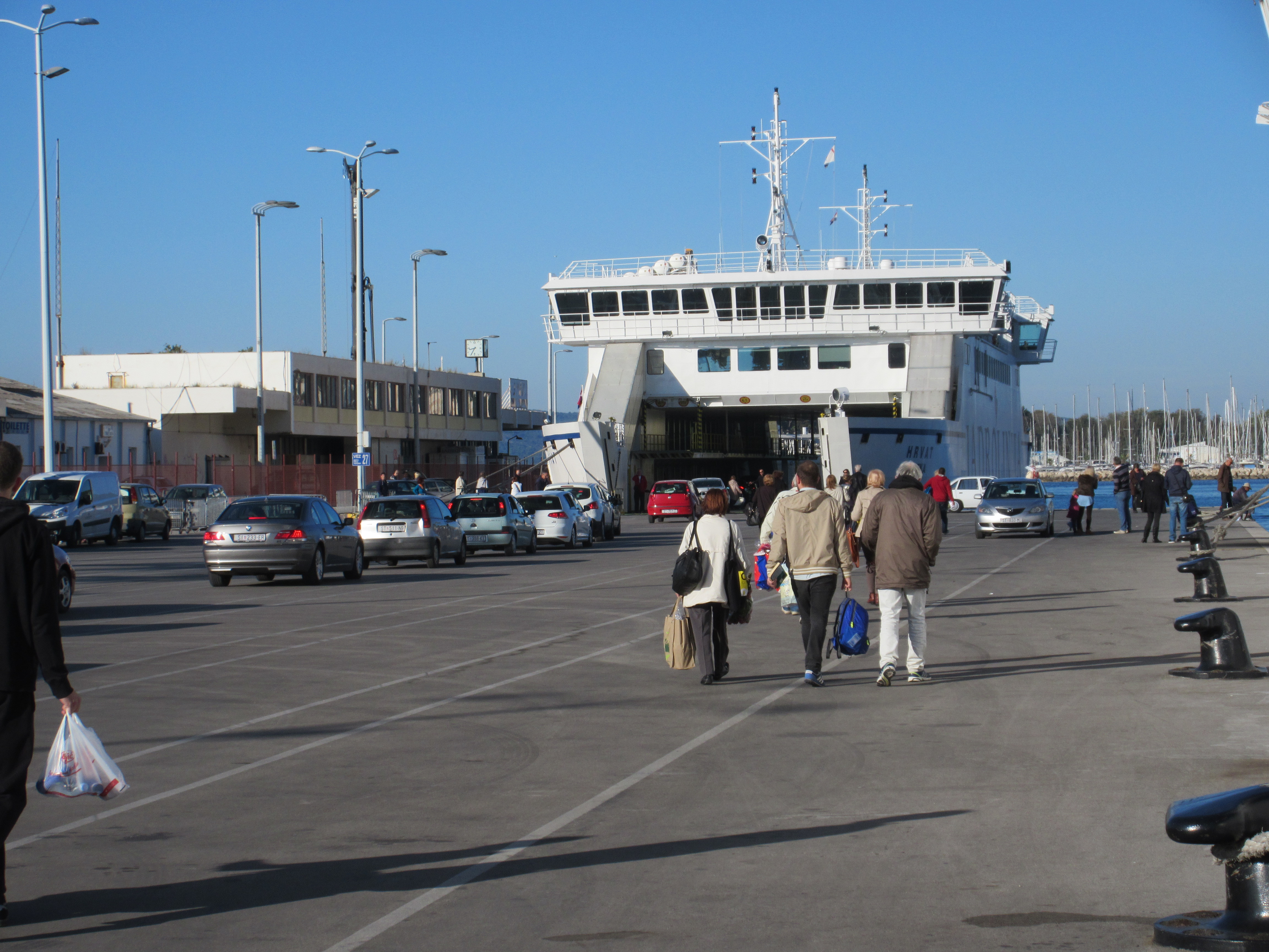
Boarding a ferry to visit a nearby island. Cars and pedestrians all come in and out together.
One of the great things about Split is the large ferry dock. We have now taken ferries to four different islands for day trips or overnight. There are slower car ferries that also take walk-on passengers and faster catamarans that only take foot traffic. The ride can be 45-160 minutes long but hasn’t cost more than $8. It takes less than 10 minutes to walk to the farthest ferry dock from where we are staying.
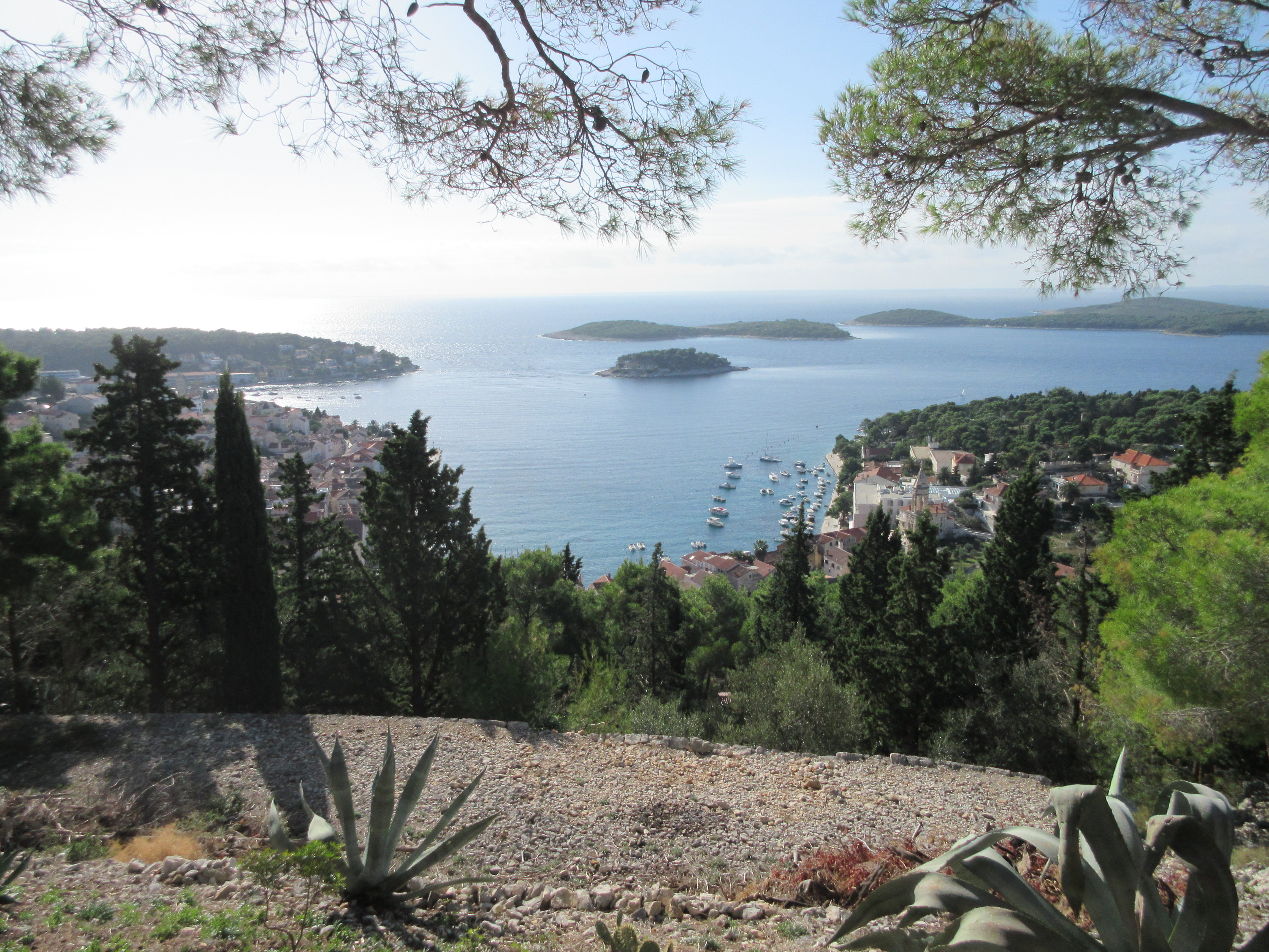
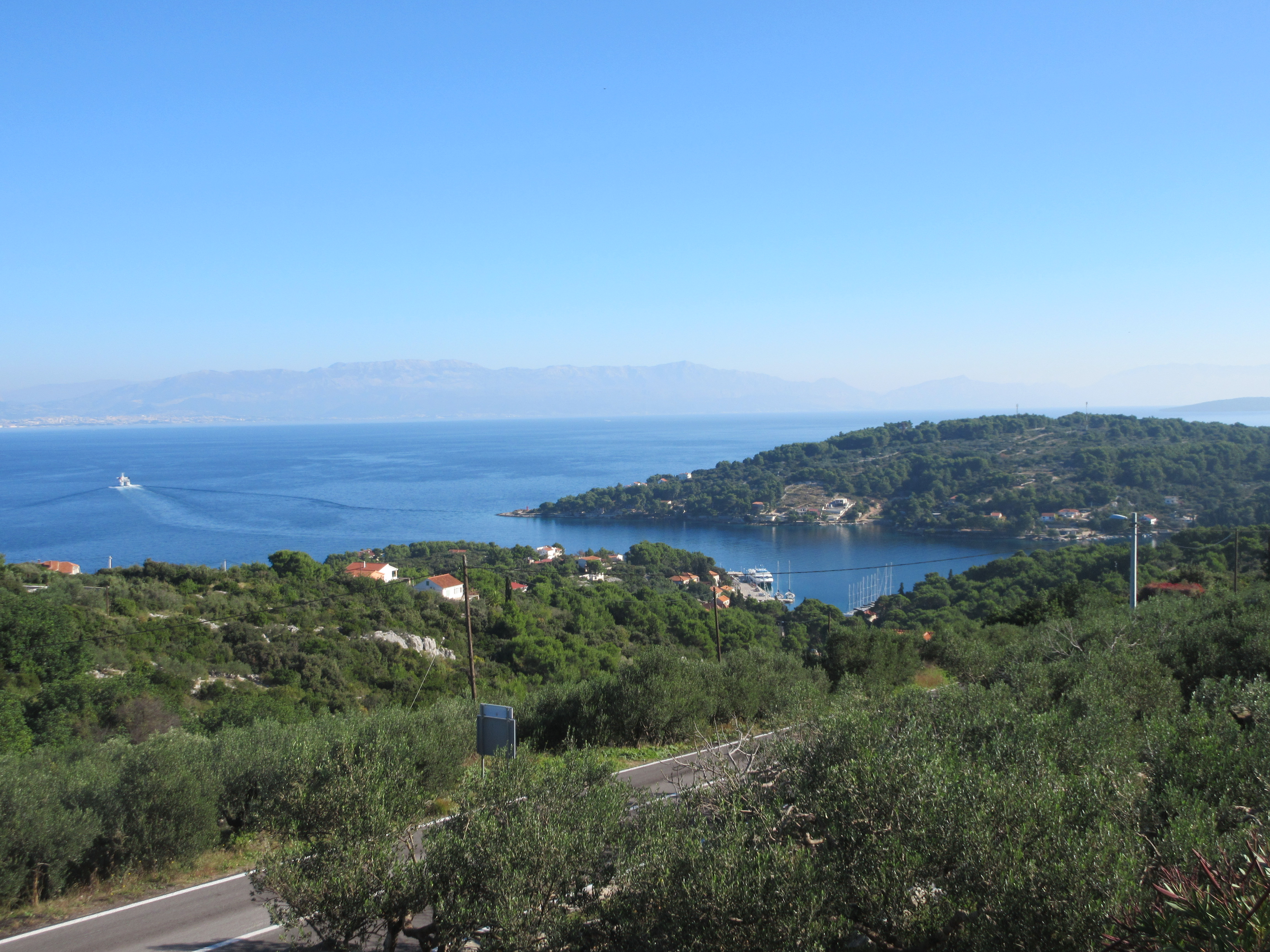
View over Hvar town, marina, and islets as seen from the fortress.
On the islands the pace of life is calmer than in Split. Very small towns are spread out on large islands. As one taxi driver told us, there is no industry beyond tourism and small-scale agriculture. He added that also means there is no noise, no pollution, and little stress. The islands also get more sunshine than the mainland and are very popular for both foreigners and Croatians in the summer. The shorelines are fingered, creating many small bays. Human history on the islands goes back thousands of years with multiple archeological sites.
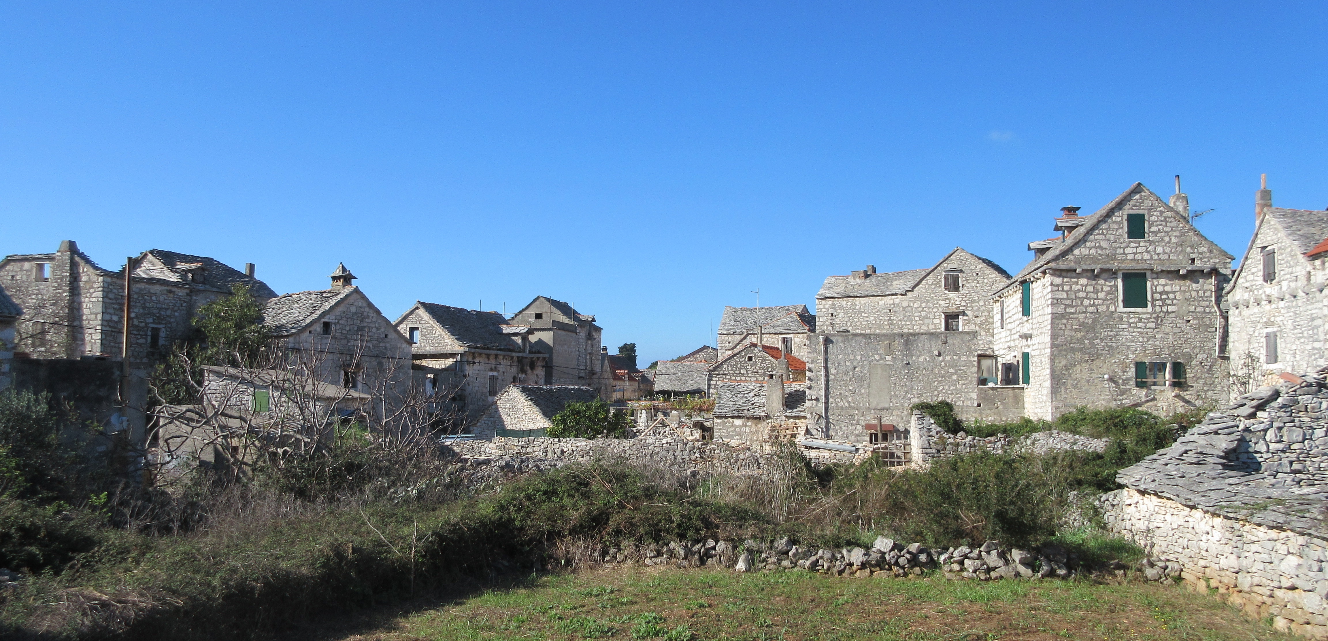
Grohote on Šolta Island had many abandoned buildings due the high rate of emigration.
Today the islands are sleepy with many abandoned-looking houses. It didn’t used to be that way. The Greeks introduced grapes and wine making 2500 years ago. Viticulture became a significant industry on the islands, and vineyards covered the land. Around the turn of the 20th century came a grape blight that wiped out virtually all of the vines and collapsed the local economy. That started a mass emigration that was furthered by the challenges of war, continuing through the 1990s when Croatia separated from Yugoslavia and became an independent country. Four million people live in Croatia today. Exact numbers for the diaspora are impossible to come by but the estimates say two to four million Croatians left over the last 150 years.
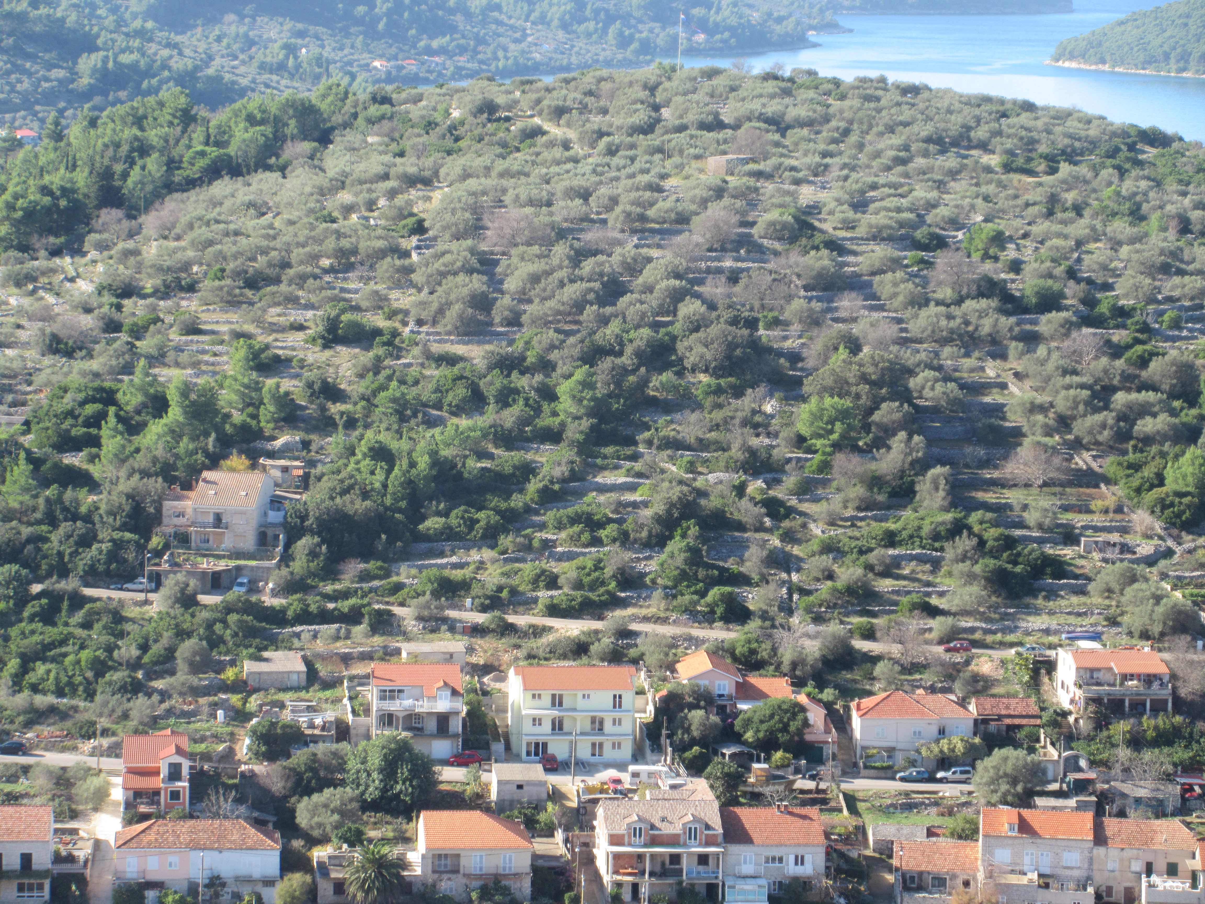
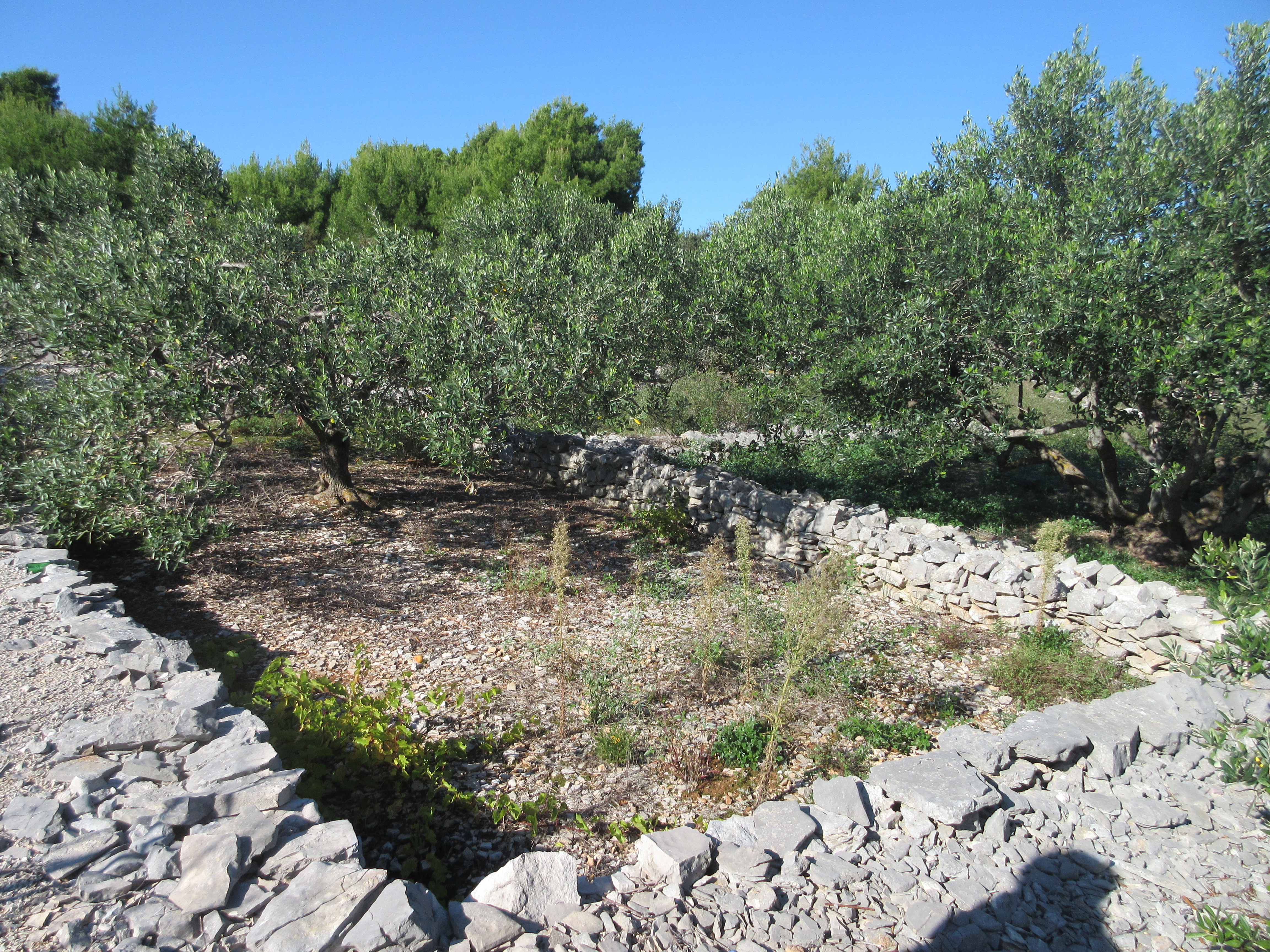
If you look between the olive trees you can see rows of stacked rocks that both terraced the hill and cleared the land enough to farm it. Korčula Island.
On the islands rock piles and rock walls are ubiquitous, a sign of when the population was much larger and more food production was happening. The soil is high quality but mixed with rock. To create usable land for planting, rocks were removed and stacked. In some places, it looks like half the area is covered in neat rock piles ranging from 2 to 6 feet tall. Slopes are terraced. It’s hard to imagine the tremendous amount of work it took to create fertile areas on these islands. I’ve only spent a few days picking rocks, which gave me enough to complain about but doesn’t even register to what these farmers did! We saw many active gardens next to houses and in town that show that the people who live here now are still growing food.
We found one restaurant open on the island of Šolta. We were the only guests but were just in time to eat what the family had prepared for their lunch.
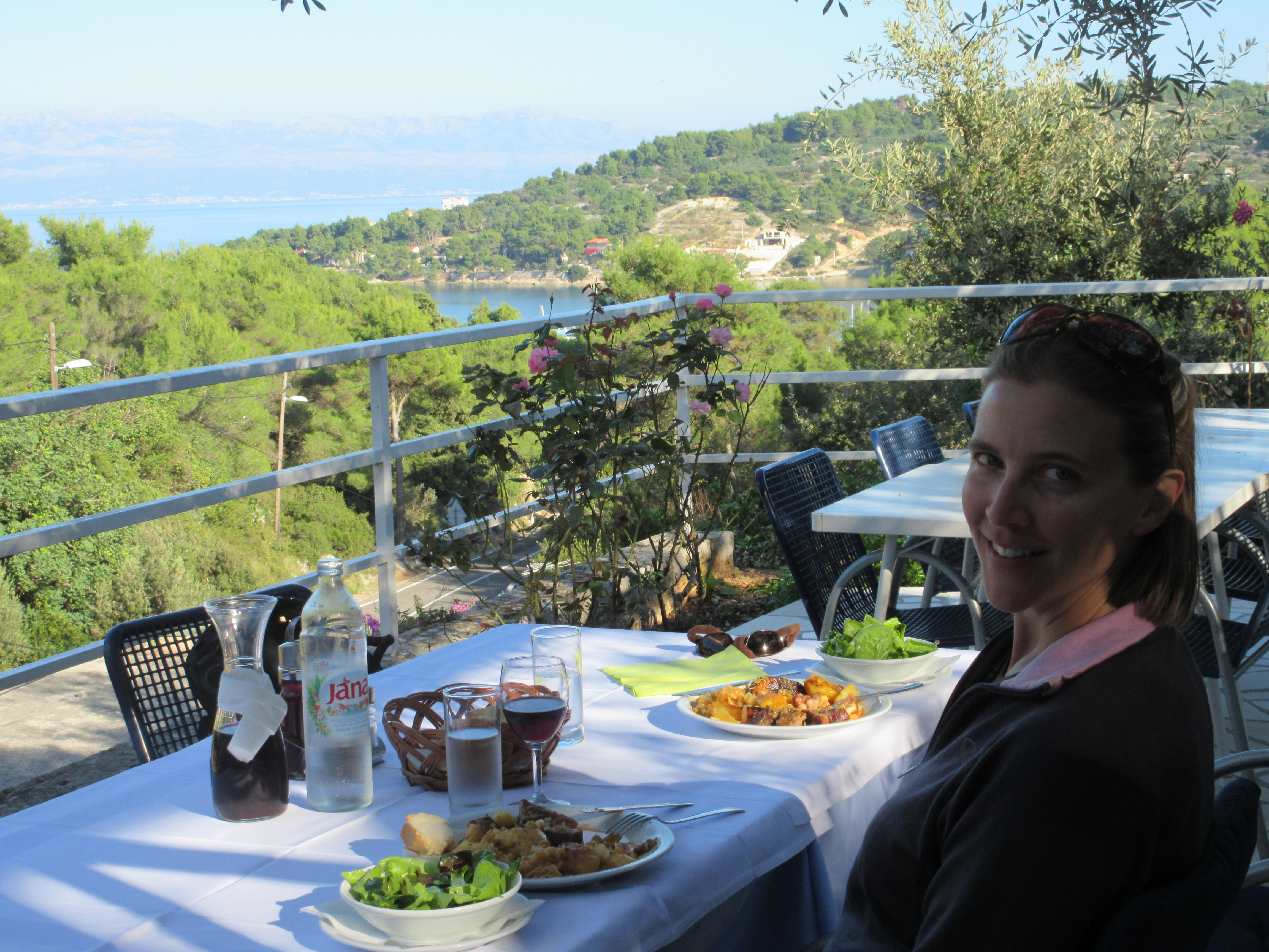
Šolta is the smallest island in this area. The ferry docks in a tiny village with a row of houses along the shore and one cafe. We walked 2k up to Grohote, the town on the top of the island. On the way, we passed small farms and olive trees. Neighborhoods of tumbling stone houses were beautiful in the way that nature reclaiming human effort often is. The cleared land around was fallow with overgrown grass. We spotted another fire lookout on a ridge overlooking Grohote and the far shore of the island. On our way back to the ferry, we sought out the one restaurant in walking distance open on Sunday. We were the only guests. They gladly pulled out a table cloth, brought out cushions, and welcomed us. The family who runs the place was just about to sit down for their meal and we got lucky. They had prepared a traditional meal called peka. It is essentially a one-pot meal with the pot buried in hot coals. The juices cook together; it was delicious!
The old part of Hvar town is full of beautiful little streets.
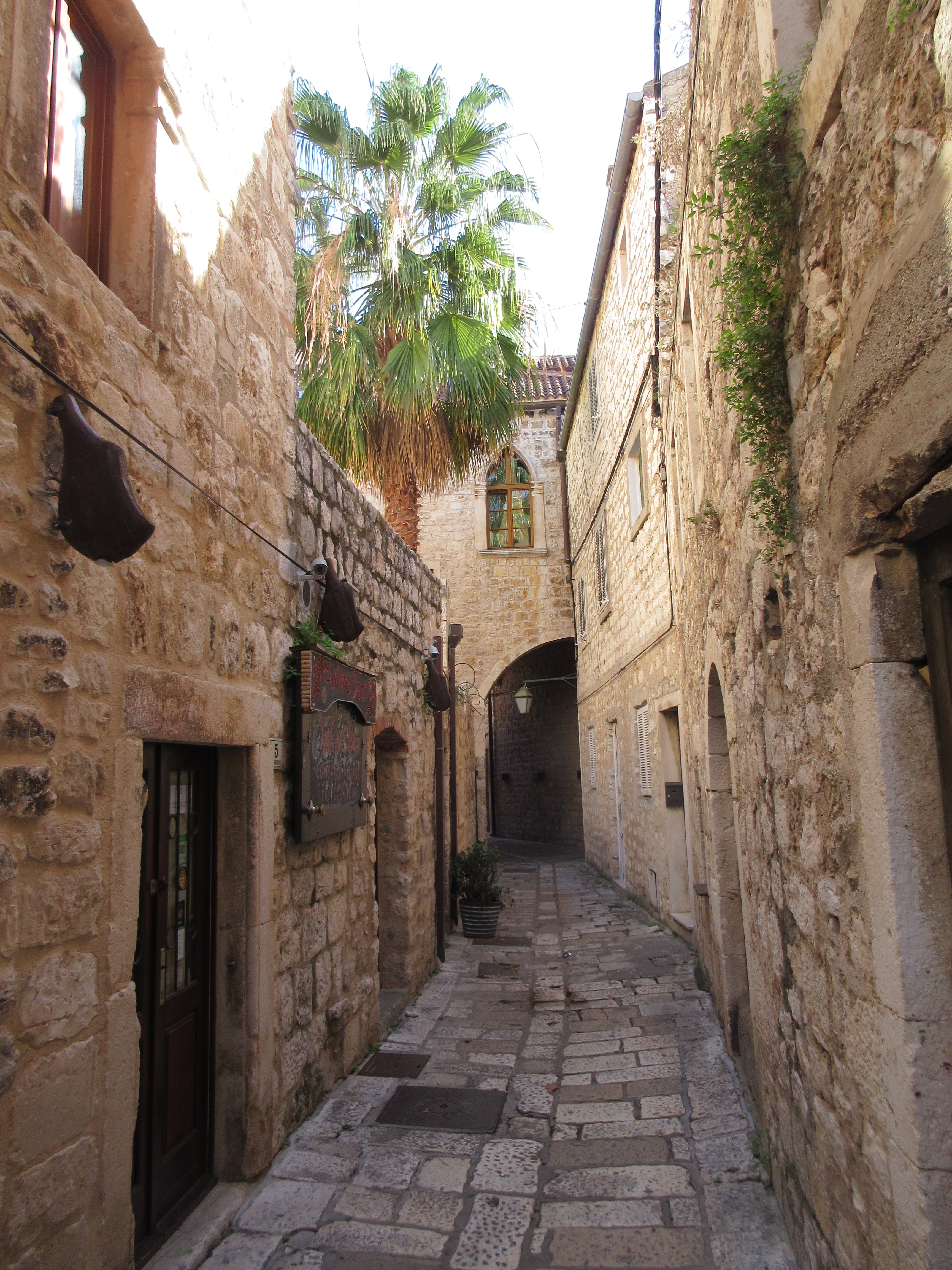
We also visited Brač, Hvar, and Korčula, which are all much larger islands (110-150 square miles each). On these islands, it is easy to see signs that we are off-season. Beach bars, restaurants, and beach facilities are all closed and shuttered. However, we never had trouble finding a good inexpensive place to eat, often seated outside in the warm sun. Many towns have an old medieval center with narrow winding cobble lanes and stone houses leaning overhead. On Hvar, we looked at the archeological remnants of Pharos, a Greek town settled 2,400 years ago, and the plots of land that the Greeks divided for farmers. Those divisions are still used today and make the area a UNESCO World Heritage Site. On Korčula, we visited a cave that contains signs of human habitation beginning 20,000 years ago. On Brač, we walked through a lovely seaside cemetery on All Souls Day as families placed flowers and candles on the graves of loved ones.
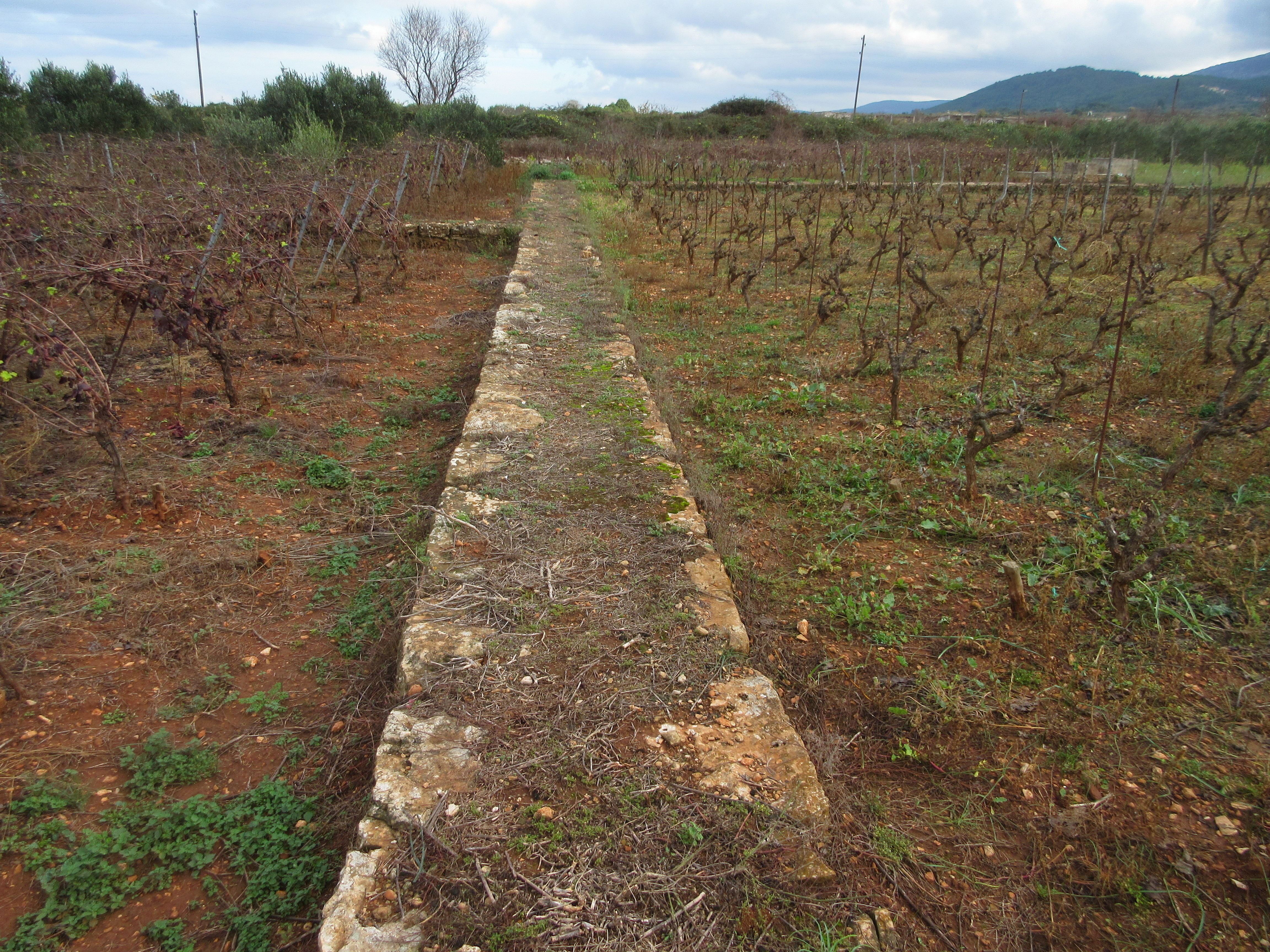
The Greeks plotted Stari Grad Plain with 90 degree angles and farm plots of standard size in 384 BC. The rock wall doubles as a narrow road.
You can see more pictures from our island visits in the Croatia Photo Gallery. Some stories are best told with a picture so you’ll find things in our photos we didn’t share in the text.
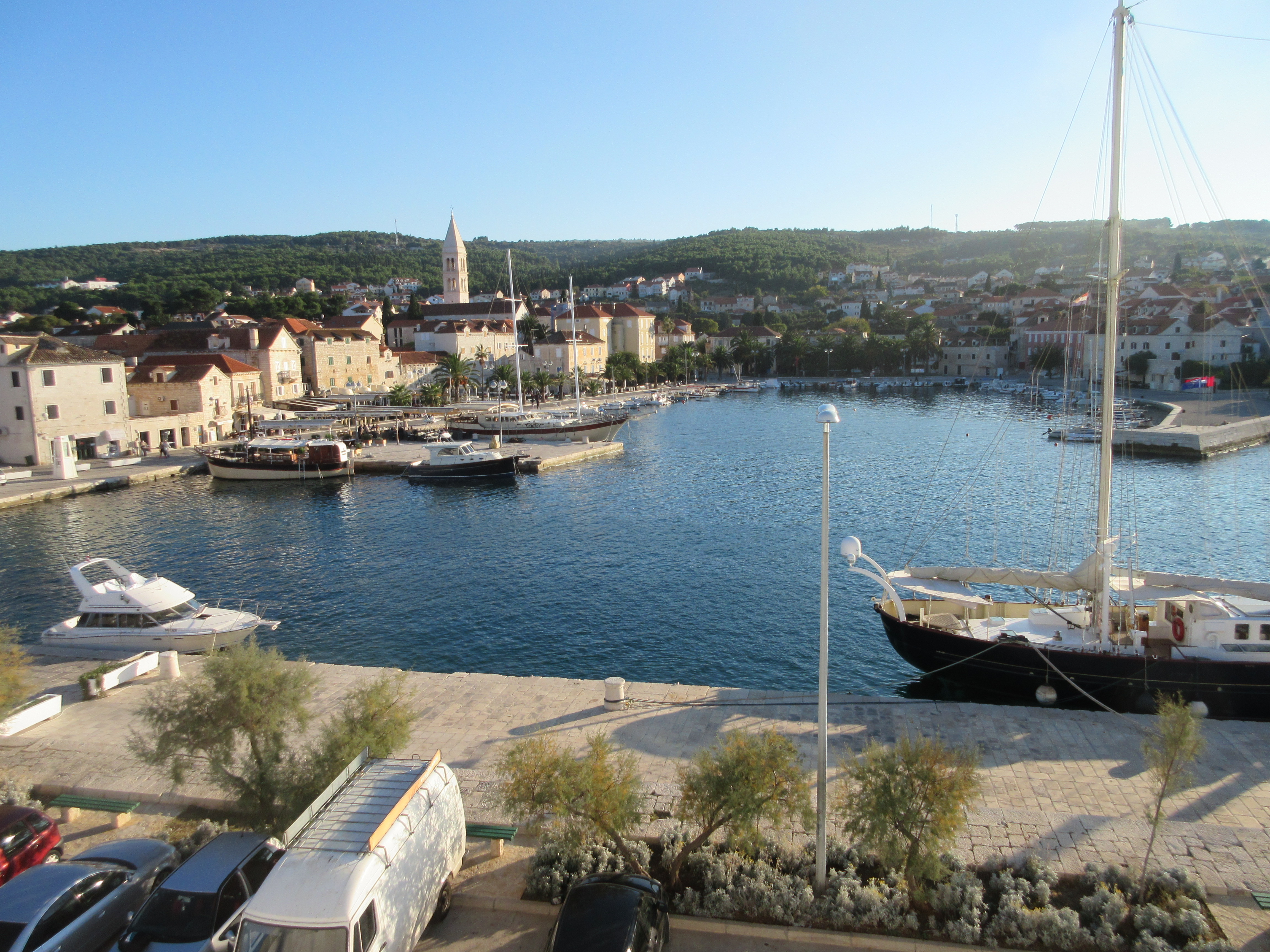
The harbor of Supetar on the island of Brač, as we came in on the ferry.
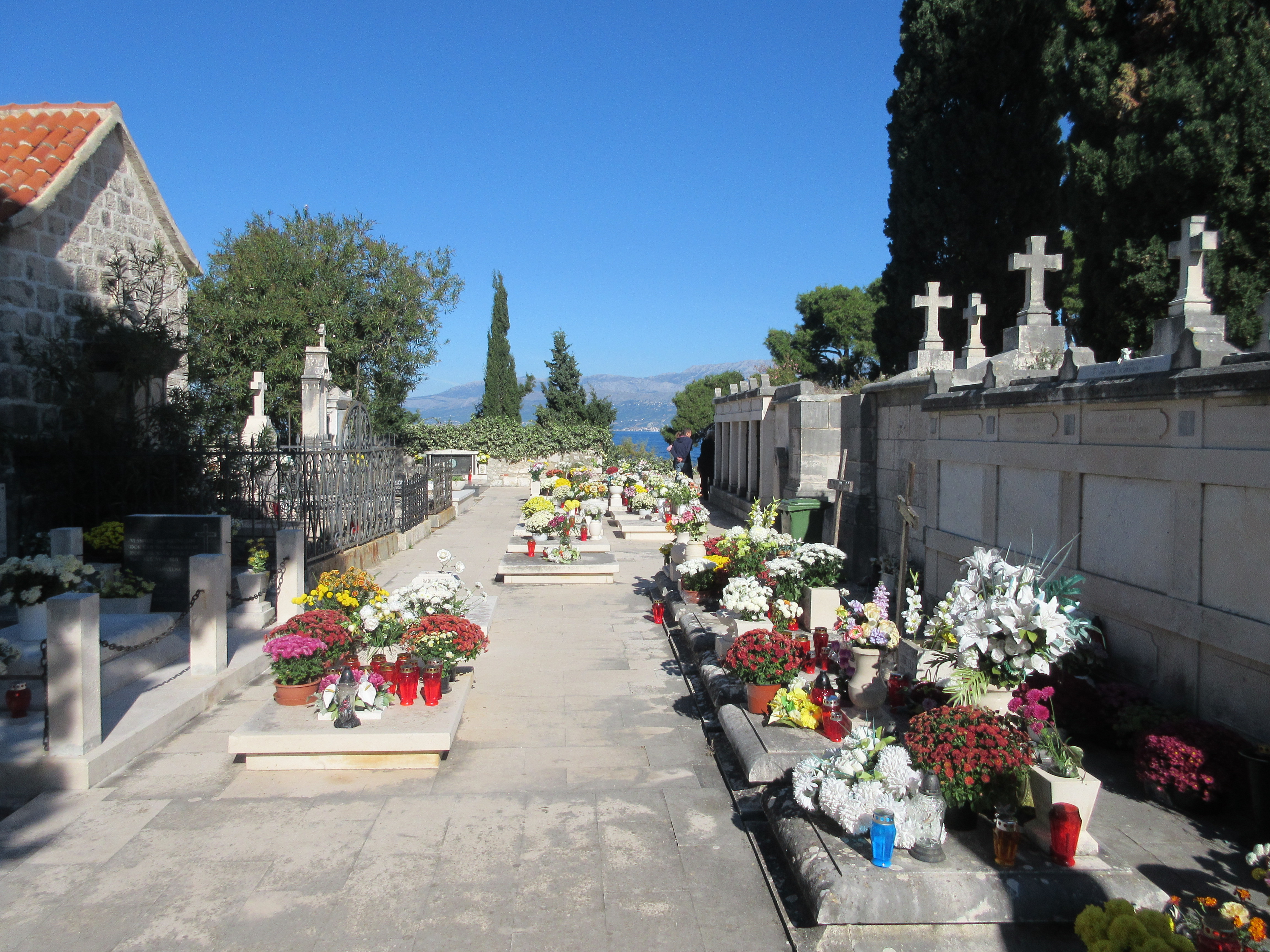
November 1 is All Souls Day and Croatians celebrated by taking flower and candles to the graves of family members.
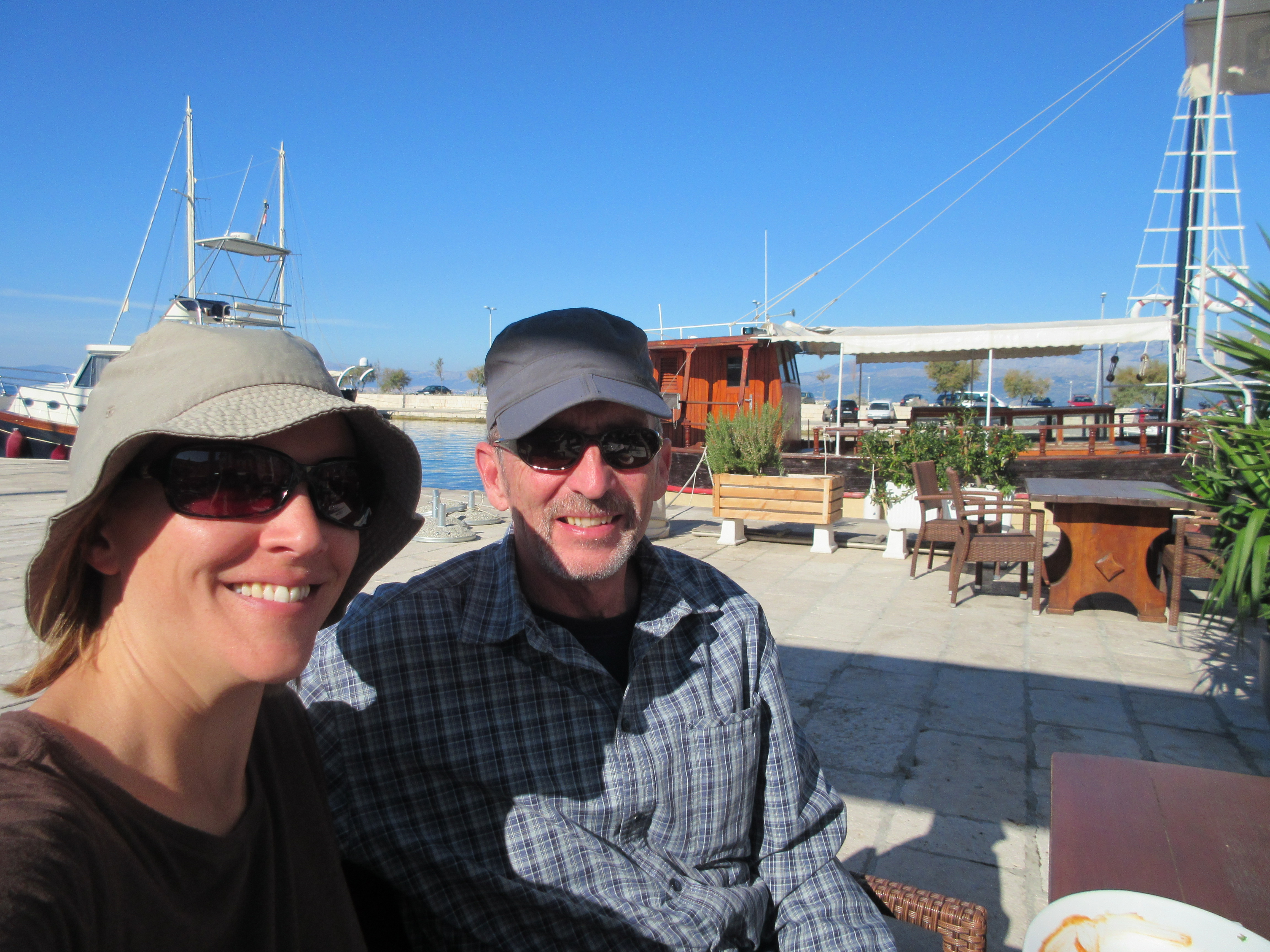
November 1. We ate lunch outside in the bright sun and 70 degree weather. We nearly had the restaurant to ourselves. Yay for the off-season!
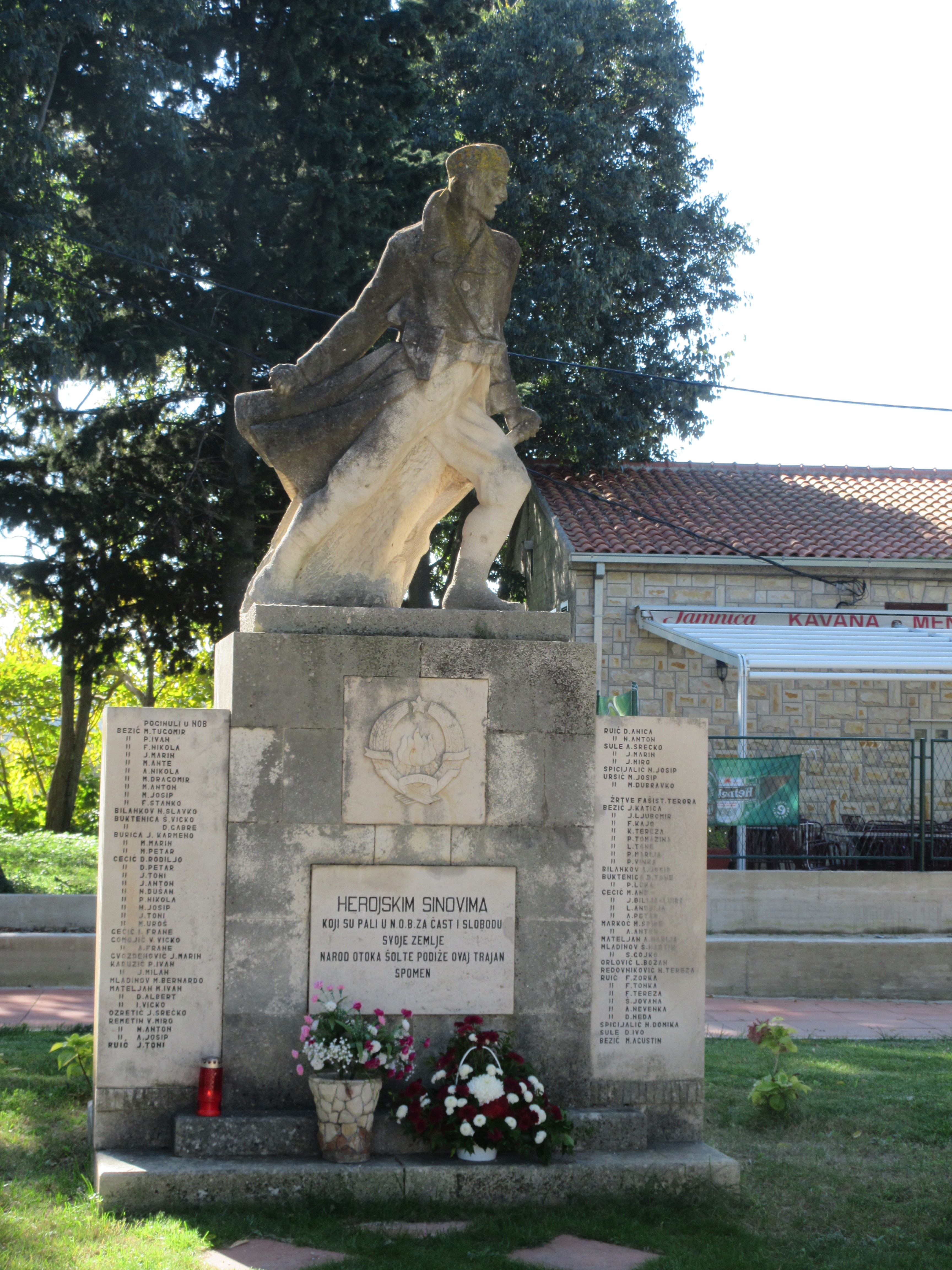
A WWII memorial on Šolta. The Partisan resistance to Nazi occupation reached a high level in Yugoslavia (including what is now Croatia). By the end of the war their forces numbered over 800,000 with an organized army, air force, and navy. The Partisans pushed the German occupiers out in 1944.
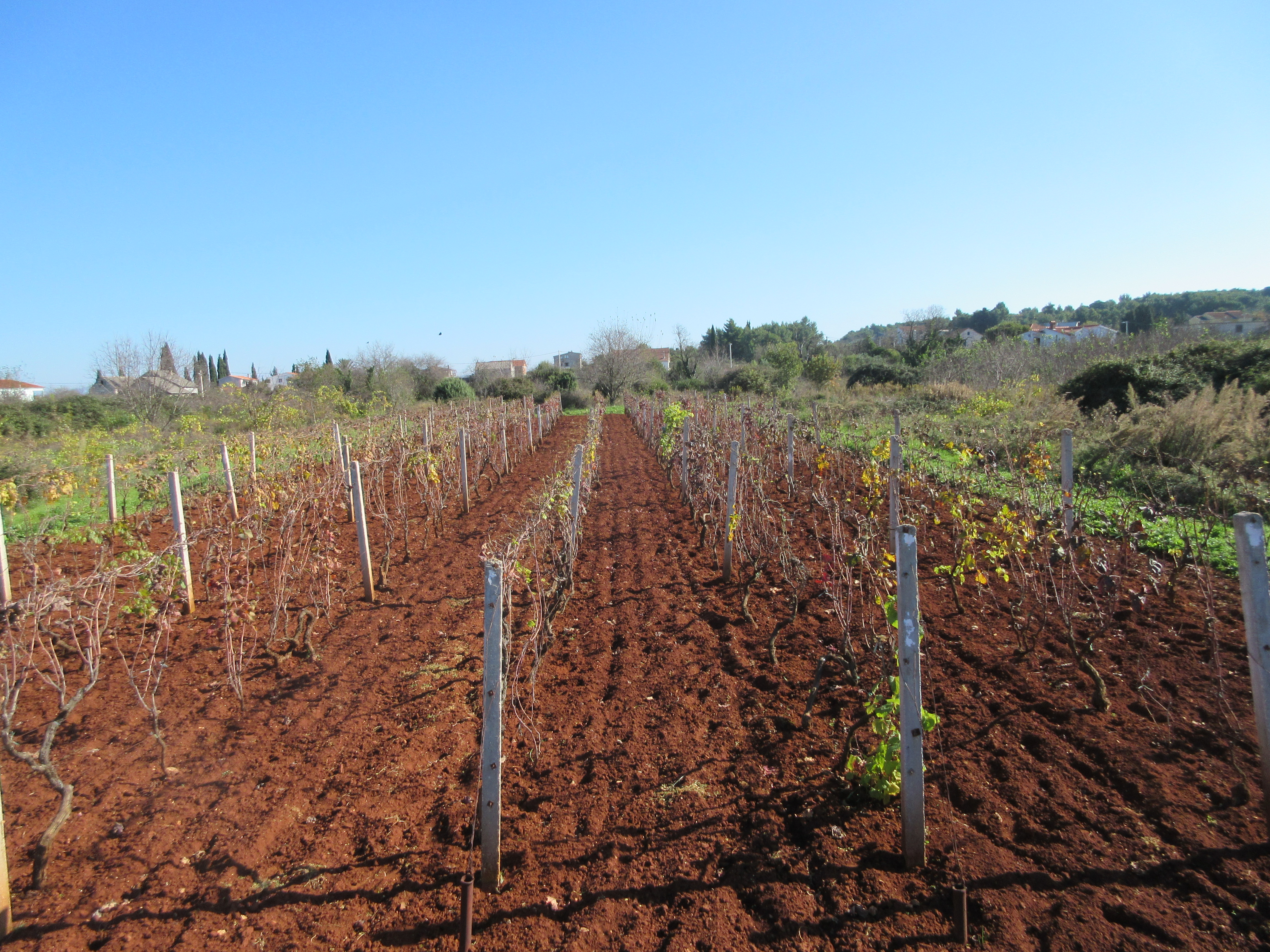
Fertile red soil on Šolta, here growing grapes.

A small round stone hut built into a wall. The exact use of these ancient constructions is unknown. Today they are used by farmers for storage.
The soil is fertile but very rocky so the land is cleared and rocks stacked, often in small walls, like around these olive trees.
The ferry leaving tiny Rogač on Šolta Island returning to Split, seen in the distance.
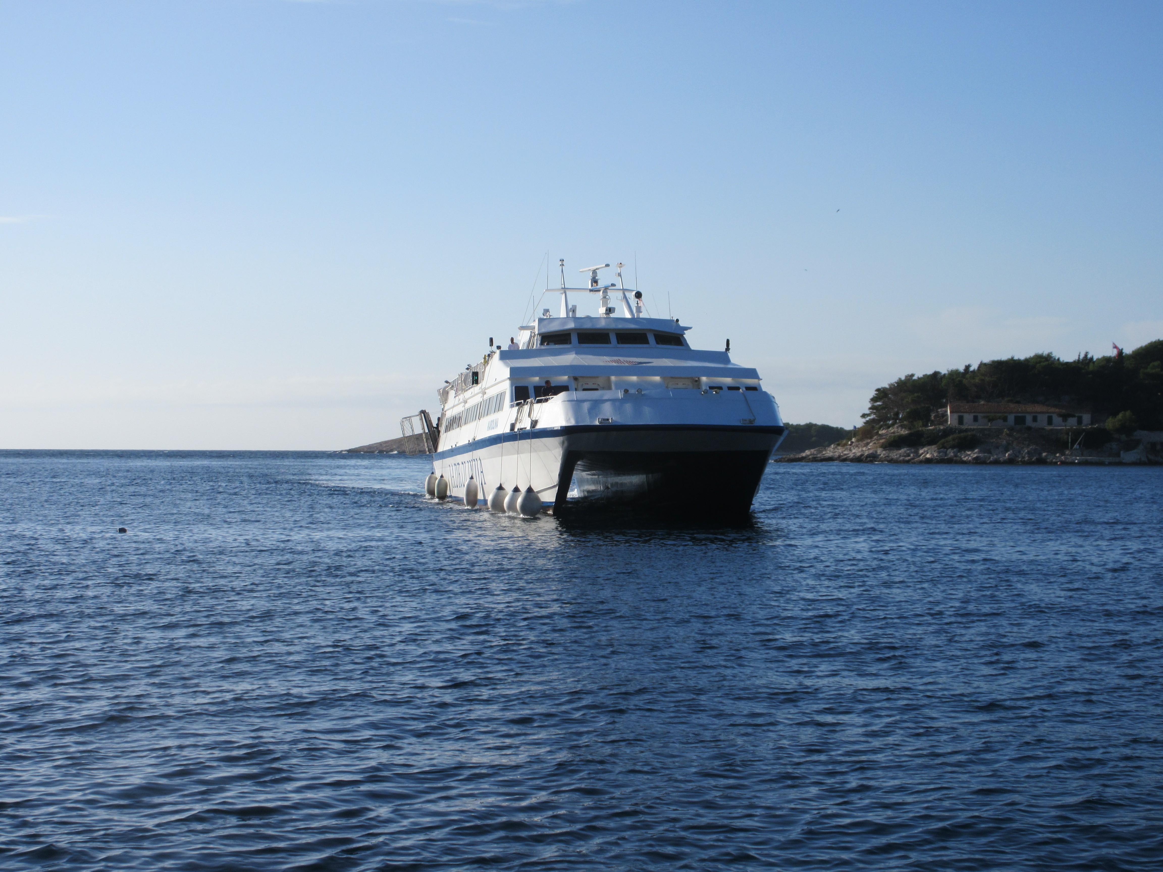
Passenger only catamaran ferry. We clocked our average speed as 30 knots.
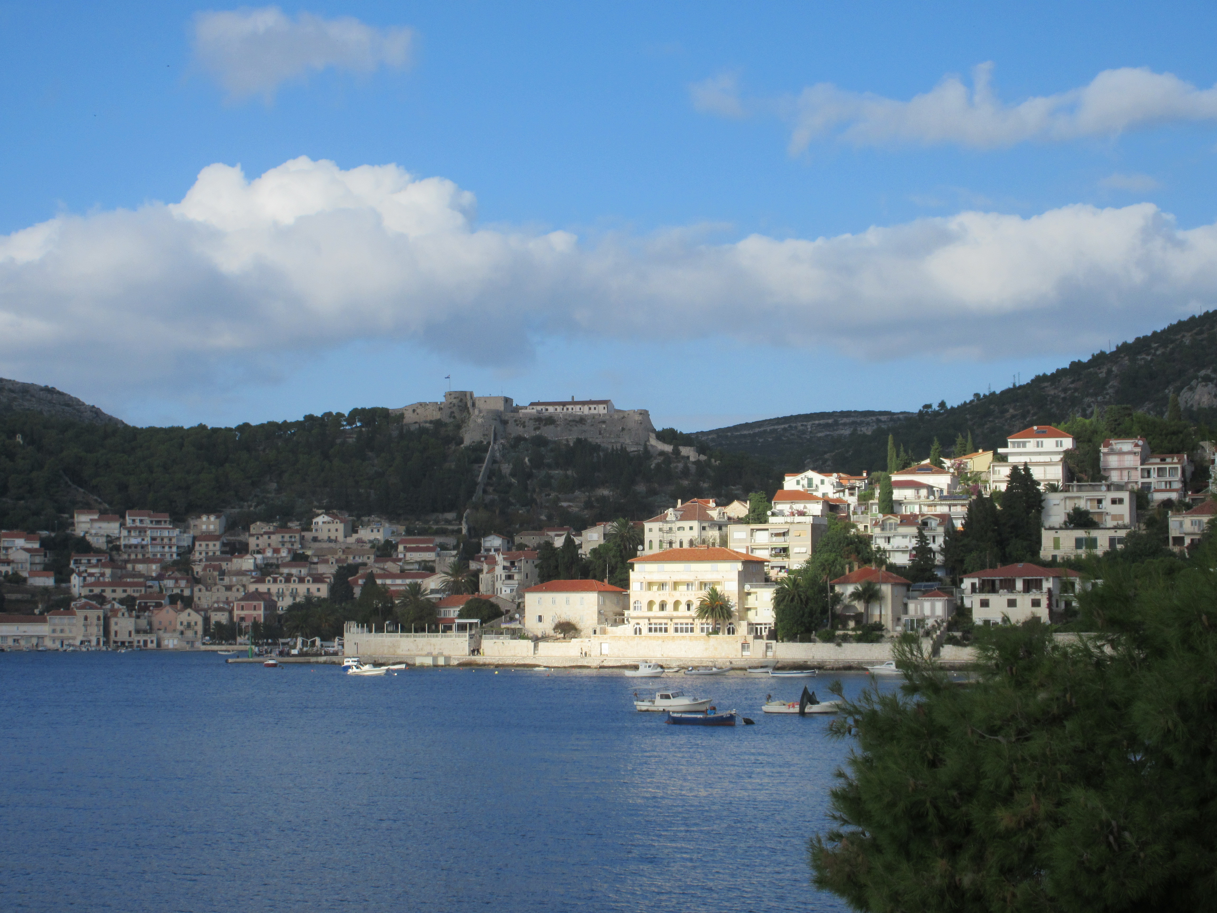
Hvar town with the Venetian fortress perched on top of the hill. Note the old town wall running straight uphill to the fort.
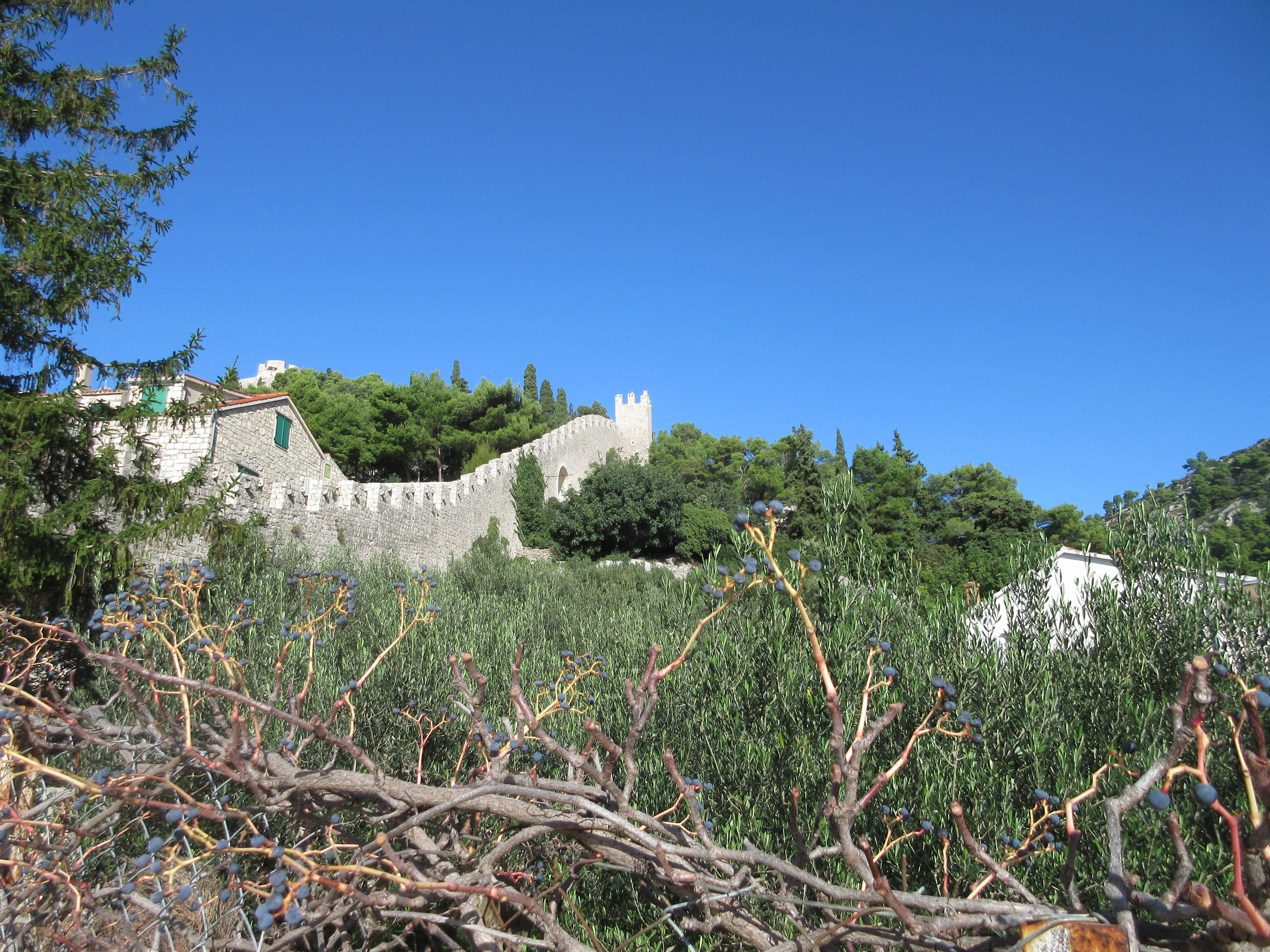
The seven-century-old wall that surrounds old Hvar town.
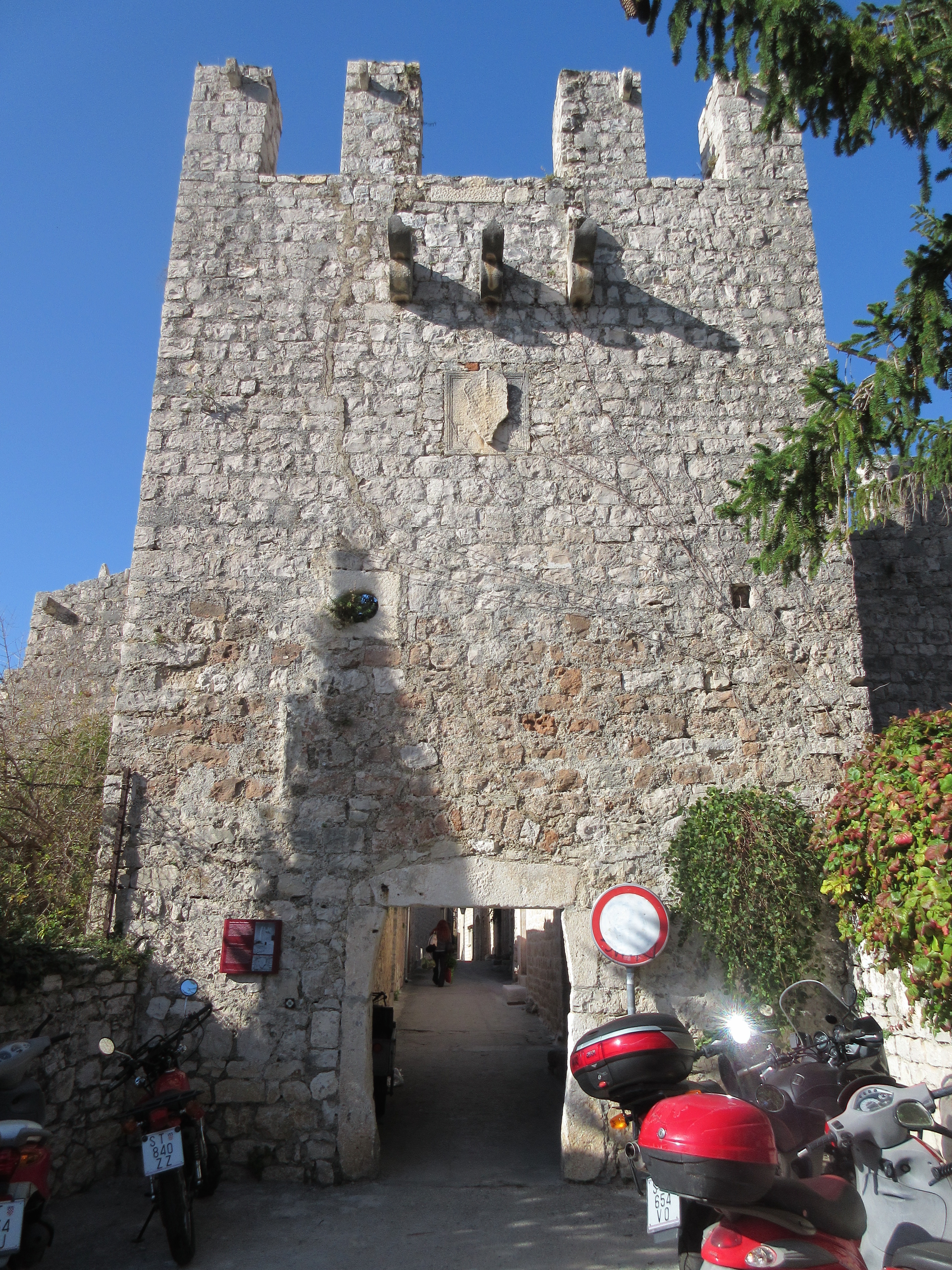
One of the gates into Hvar town. The fat gates cracked us up.
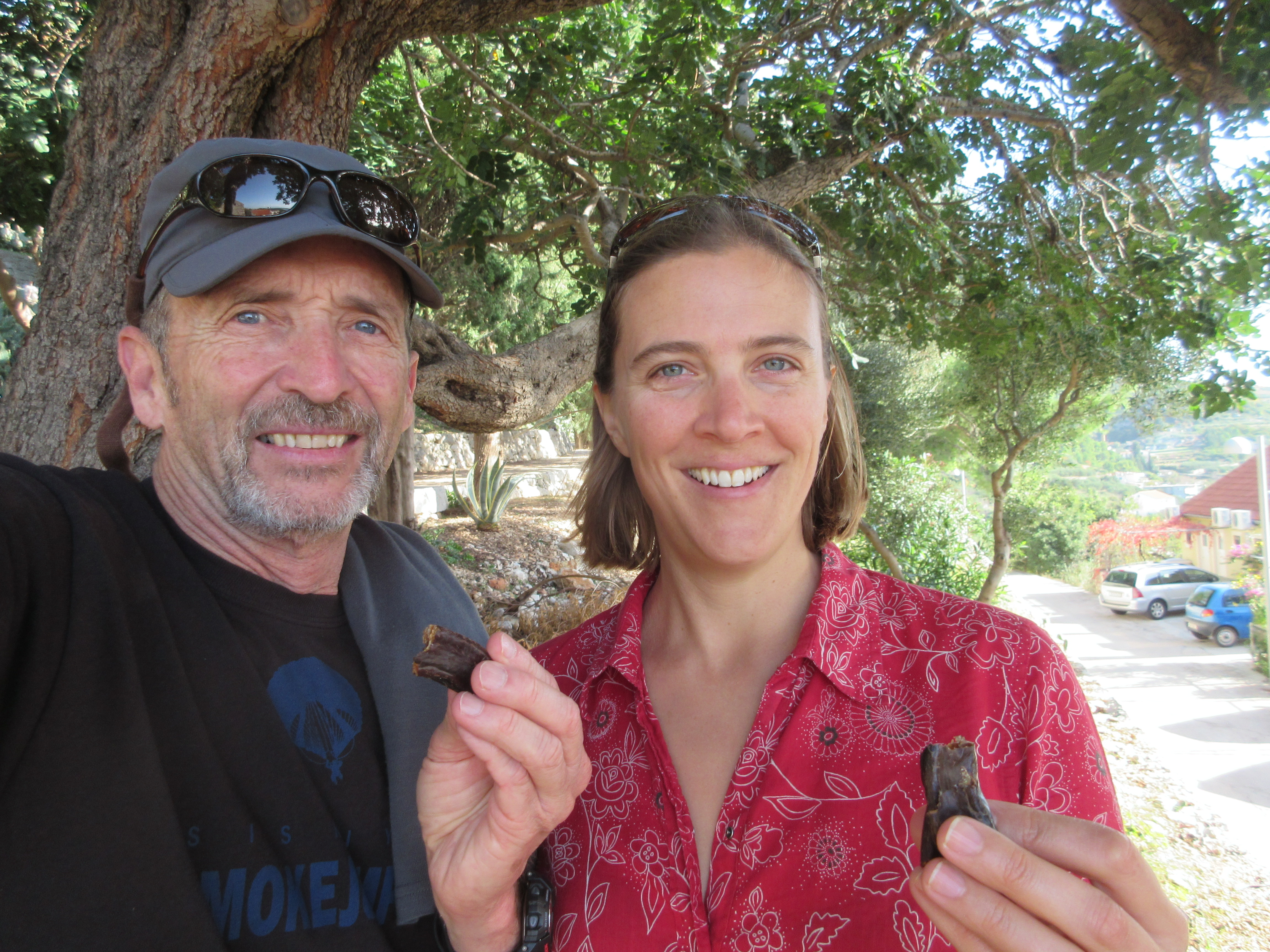
Following the guidance of locals we picked carob pods off the tree and had a nice snack.
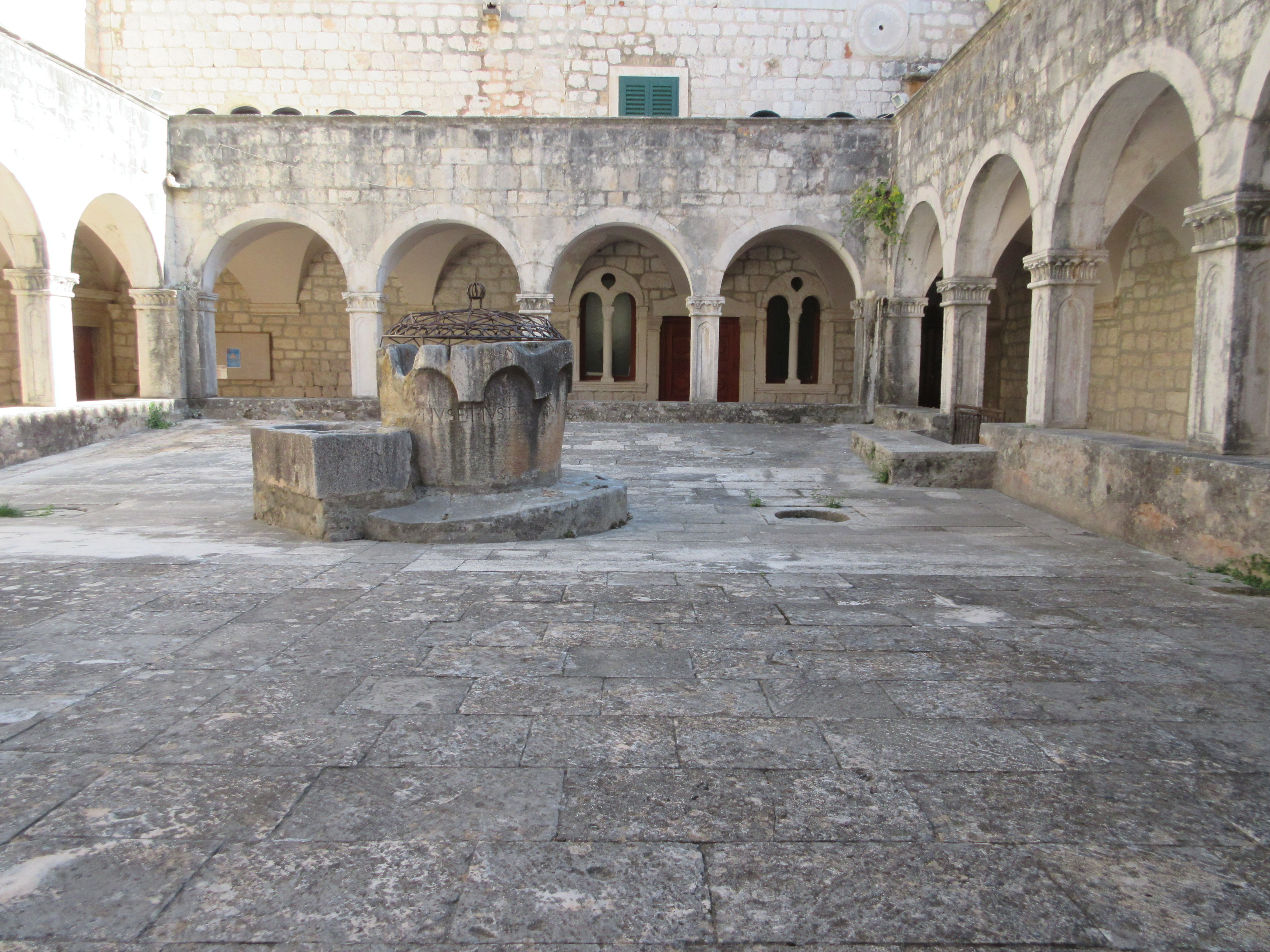
Water storage is important in this dry country. Most churches, like this one, created an internal courtyard that also served as a water catchment.
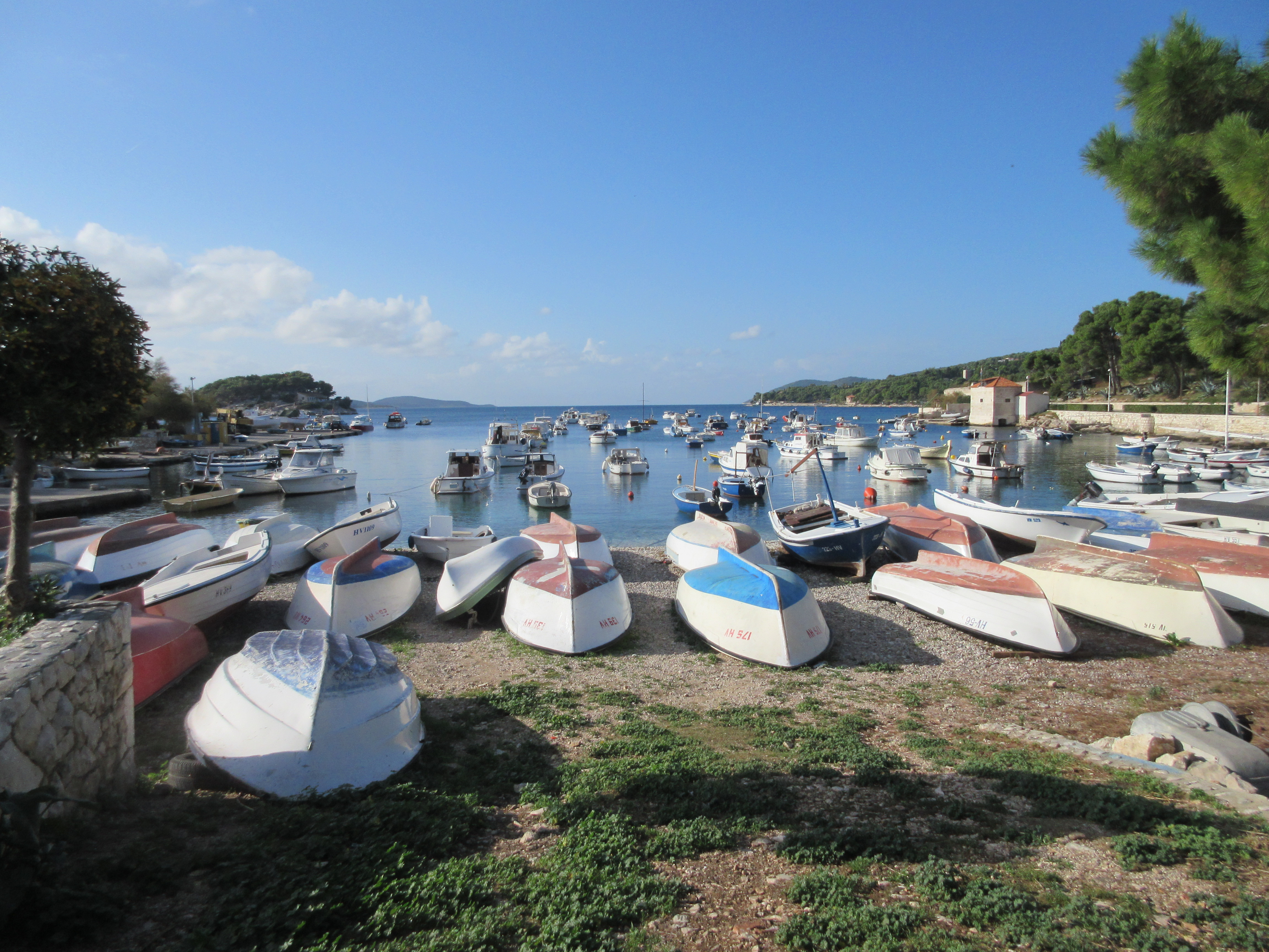
One of the many small bays in Hvar town. These are mostly fishing boats. In the summer, these waters are far more crowded with yachts.
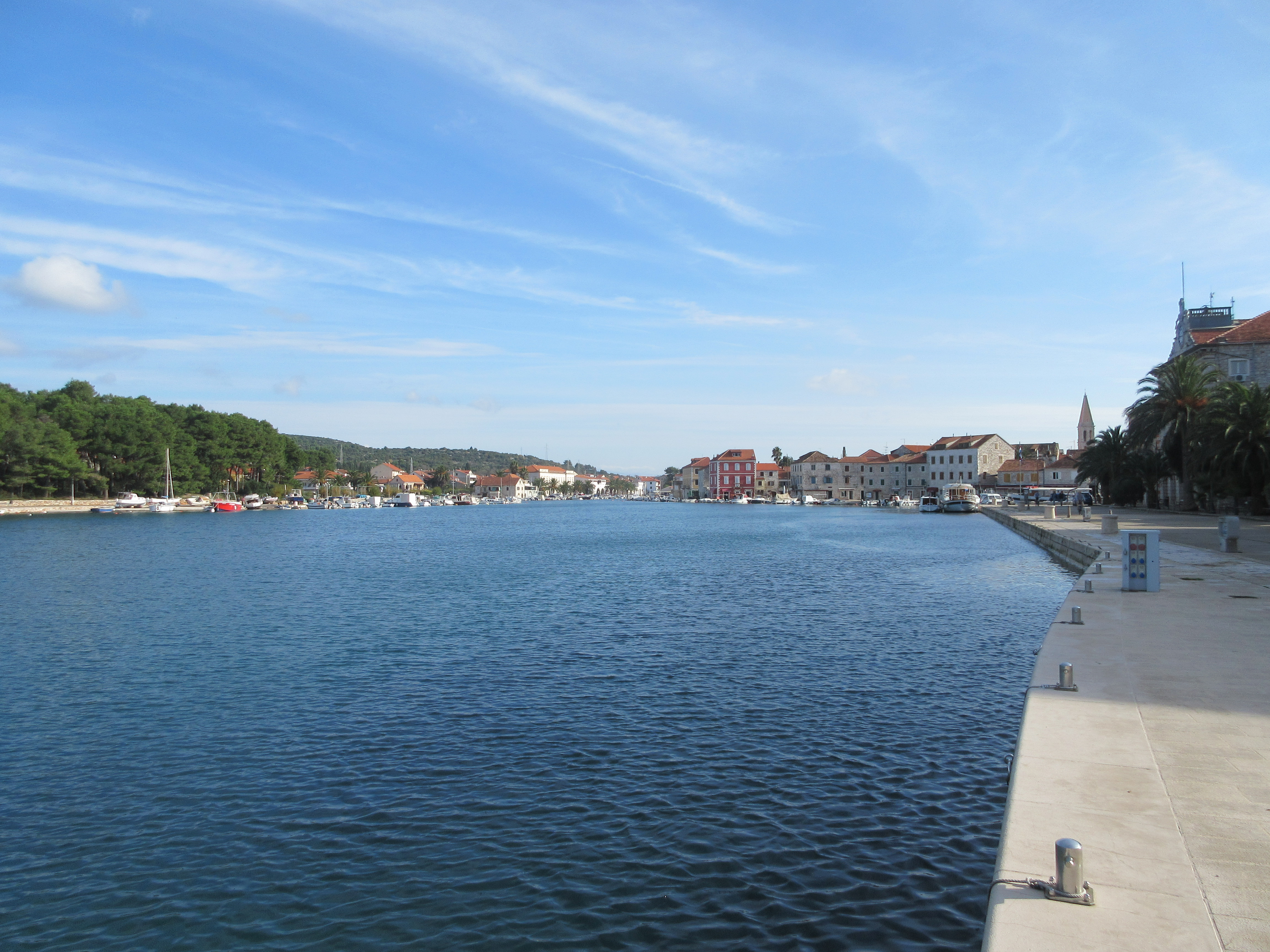
Stari Grad on Hvar. The first protected harbor where the Greeks settled 2,400 years ago.
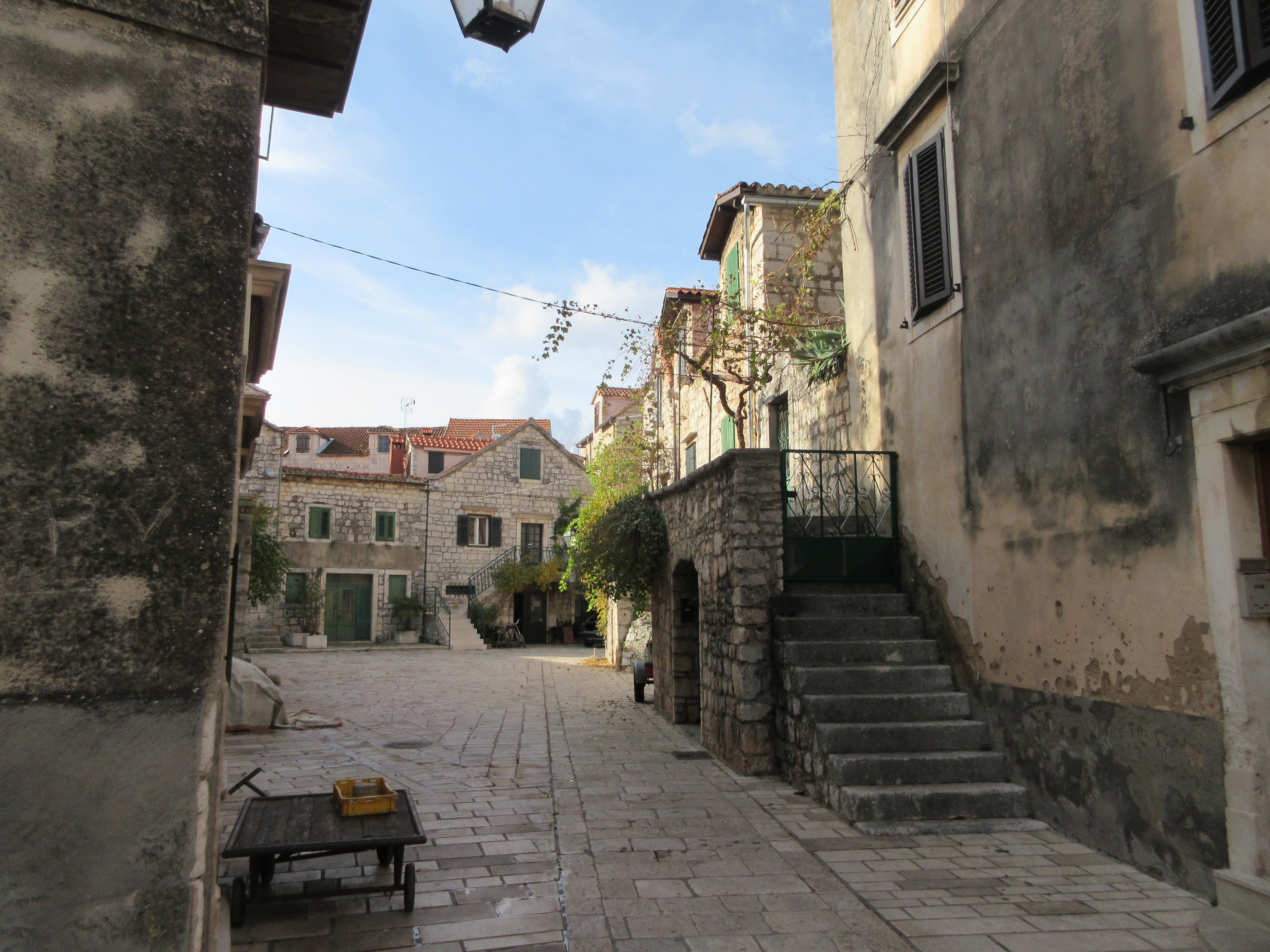
Stari Grad is full of these charming little courtyards and medieval stone houses.
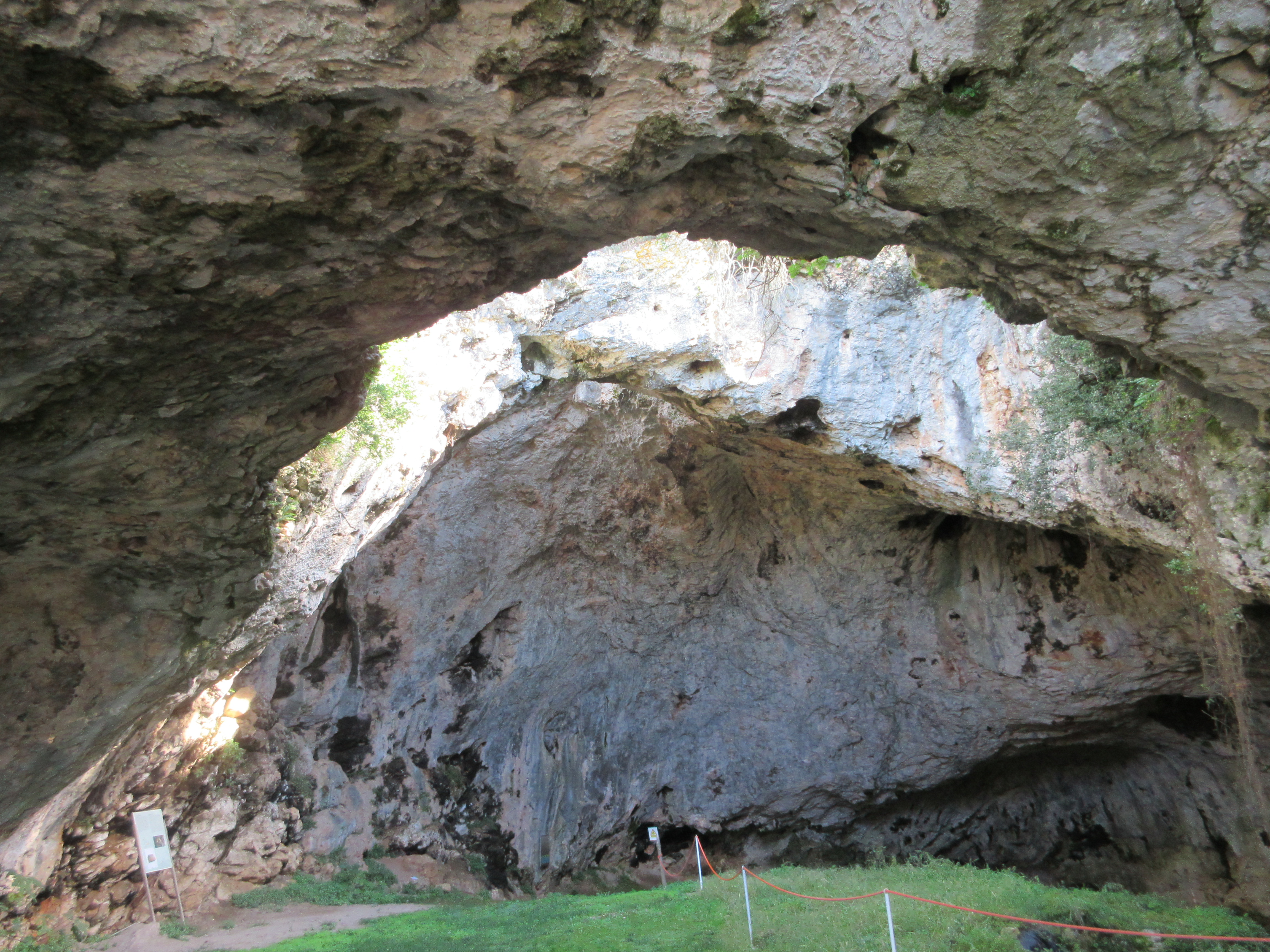
Vela Spila cave on Korčula shows signs of human habitation from 20,000 years ago through the Bronze Age.
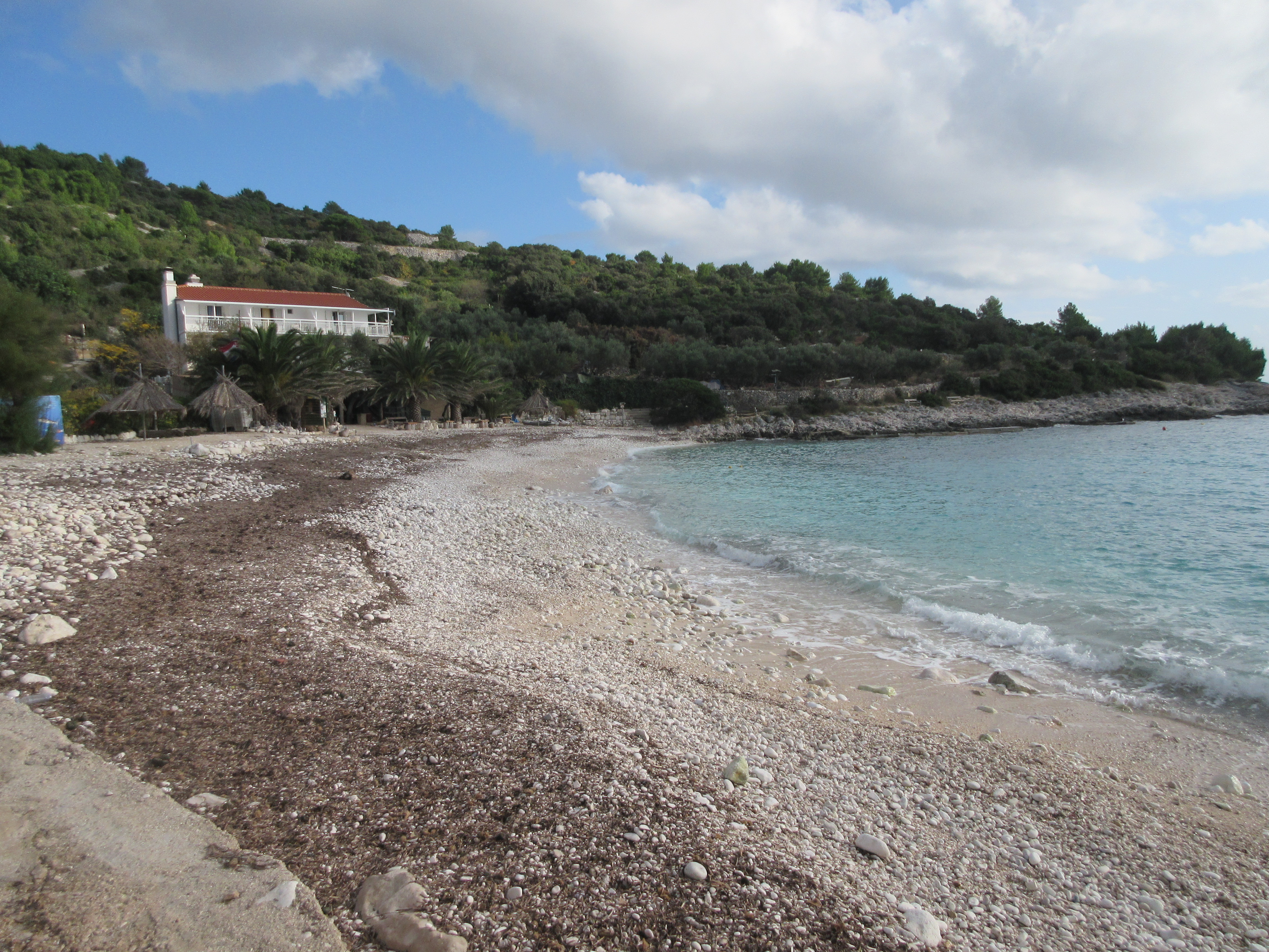
A typical rugged Croatian beach: white rocks, blue water.

Fantastic adventure! I like the idea of a restaurant that serves whatever they have made for themselves for lunch 🙂
Hello Jim and Megan,
My name is Cesar Rizo, I’m currently taking a special effects class for movies and tv, and one of the assingments is to take a regular day shot and add pools of rain water and to take a day shot and transform it into a night shot, for both of these things I would love to use your image subtitled “Stari Grad is full of these charming little courtyards and medieval stone houses.” The image will not be sold or printed in any way, and you’ll be credited as the author of the picture.
Hope to hear from you soon and show you the final images.
Cesar
Hello Cesar, you are most welcome to use this photo. Good luck with your assignment and we’d like to see the final products.